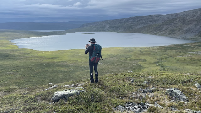
Last week I went with Jarmo Ruuth and Duncan Simey to look at Njiellalajävri lake and surroundings in the Käsivarsi wilderness area. This is a far-away area almost at the Norwegian border. We saw no one in the area except for a few reindeer. There are not even common hiking paths. The Internet knows very little about this lake, not even a picture. Despite the incredible beauty of the lakes and the rock! We knew the area only through satellite images, geological surveys and maps.
While it was a wonderful trip with hiking, beautiful barren scenery and even some skiing, the main purpose of the trip was to look at the odd lake, Njiellalajävri in the high plains. This up to 2km long lake has no outflow but per our measurements drops 7cm/day. There’s also known limestone layers, some visible directly at the lake.
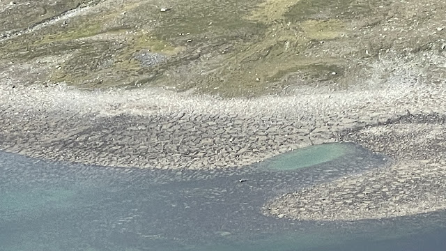
Water drop in the lake, 12 hours before this rock was covered in water:
We looked at the lake and tried to identify where the water goes. It could be just filtering through broken rock or other permeable layer. Or it could possibly go through limestone layer and form caves; we don’t know which of these is the case. But the water amounts are large, approx. 10 000 m3 per day. Interestingly while the lake bed is all broken rock, there are a few odd silt-filled clear depressions. On the beach and under water, from one meter to tens of meters across. Just the way the bottom is formed, or places where water goes in and draws silt with it? Again, we don’t know.
On the other side of the mountains, on Toscaljärvi, more than 100m lower Duncan identified significant rushing water sound under a cliff and a large boulder field, feeding a medium sized river. Water coming from the mountain plains, or filtered through rock layers from Njiellala? We don’t know. On either end it is clear that there’s loose rocks and air between them, but it is impossible to see under, so we don’t actually know what’s in the ground.
You can hear the sounds in this video:
Interestingly in Toscaljärvi the same river later falls into Finland’s (only?) underground river again in a limestone layer, for about 100 m. A sight to see, and already known about since 1950s but not feasible to enter as the cave is too full of water. And running too fast even for divers.
We also toured the area looking for different rock layers. And possible cave entrances, including smaller boulder caves. Nice holes were found but everything was very small, few meters at most.
We did about 64 kms of hiking in five days. Rock hopping, most of the time. In my case with a still painful knee, which amazingly held up.
Entering the Toscaljärvi green, lush paradise after hiking in rocky mountains:
Toscaljärvi underground river, from where it flows as a river to the sink and then to the exit:
Toscaljärvi resurgence:
Waterfalls near Toscaljärvi:
A small canyon and mini-cave:
Njiellalanjávri:
Potential sinks in Njiellalanjávri, from small to the massive ones:
Hiking:
Camping:
Flora:
There are additional, more detailed articles also about limestone in the area and the small cavelets we found. And there will be more in the 2023/2024 Luola magazine published by the Finnish Caving Association. See also the reports about swimming in the area. Or skiing(!).
Read more urban exploration stories from theurbanexplorer.net, and other underground stories from planetcaver.net. Read the full Planetskier series at planetskier.net, or all blog articles from Blogspot or TGR. Photos and text and coordinates (c) 2023 by Jari Arkko, Jarmo Ruuth, and Duncan Simey. All rights reserved


No comments:
Post a Comment