Saturday, January 29, 2022

Eduskuntatalo fail

I have long wanted to ski the Parliament House stairs. And I thought today's "Valtteri" winter storm was the perfect opportunity to do that. However...  when I got to the chairs, it turned out they are being heated, and snow-free even in a once-in-a-decade storm. Sigh. What a letdown. And maybe also waste of energy :-)

Fortunately, I found some skiing at the Temppeliaukio Rock Church.

I also got stuck twice on the way home ...


This article has also appeared in TGR. Read the full Planetskier series at planetskier.net, or all blog articles from BlogspotTGR. Photos, videos, and text (c) 2022 by Jari Arkko.

Stuck with the car


I called Tero while driving back home from Valtteri-storm ski explorations. When I was nearing home, I told him that I'm only fifty meters from home and safely back without car incidents, and hung up. Twenty meters later I got stuck :-) not having yet made home. 

After some sweaty manual snow-plowing I got the car unstuck and was able to get home.


Knee testing


Today is the first time I'm on skis, after starting to have knee pains since the beginning of the year. A test on the local hill. Wish me luck!

On the hill, the knee felt good. But afterwards I had some pains. Now on the next day, it feels good again. Not sure what to think of this.

Hopefully it is on the mend.


Read the full Planetskier series at planetskier.net, or all blog articles from BlogspotTGR. Photos, videos, and text (c) 2022 by Jari Arkko.

Monday, January 17, 2022

Caver's meetup in -17 degrees


Caver’s meetup, warm even if -17 and interesting short films at Kino Jalasjärvi. And my Volvo made it 350 km away, furthest it has been! But will it last the way back? The summer’s trip reliability was 85% - what we call in the industry with the technical term “almost one nine reliability”. So the odds are pretty good!

I held a presentation on how to generate cave maps from 3D models. The presentation is here.

Our hosts had built an amazing lean-to (laavu) and it was a lot of fun having a big fire there, grilling sausages and chatting. See at the top and below!

I also managed to visit in Kollinluola, and make a scan/map of it. See here.


Trip:


Read more urban exploration stories from theurbanexplorer.net, and other underground stories from planetcaver.net. Read the full Planetskier series at planetskier.net, or all blog articles from Blogspot or TGR. Photos, videos, and text (c) 2021-2022 by Jari Arkko. All rights reserved.

First publication in a Swedish caving magazine!


My article on 3D modelling in Lummelunda was published in the Swedish Caver's Association's 'Grottan' (cave) magazine. Nice! The magazine was delivered to me rolled :-)

For the actual topic, if you don't have access to the magazine, see my earlier post which talked about some aspects of this.

Grottan can be ordered here.

Read more urban exploration stories from theurbanexplorer.net, and other underground stories from planetcaver.net. Read the full Planetskier series at planetskier.net, or all blog articles from Blogspot or TGR. Photos, videos, and text (c) 2021 by Jari Arkko. All rights reserved.

Sunday, January 16, 2022

Kollinluola - cave of the tomcat


Just before the caver's pre-xmas party,  I visited 'Kollinluola' - the cave of the tomcat. Or, the cave of Juho Korkiakoski who was also called Kolli.  It is a small cave under rocks.

It is also near Pirunpesä -- the nest of the devil. This is a massive pre-glacial erosion hole, 23 meters deep. It is a tourist attraction and accessible for a small fee.

But back to Kollinluola. Its coordinates are N 62.39841 E 22.89158. I also took a 3D model (see here) and drew automatically a map:


The map is also available in high-res as a PDF file. Of course, there's a lot of uncertainty in the actual sensor workings or the software used for this automatic generation; some fixes were manually applied to the above map, but many probably remain.

More information and pictures:


Here at warnings and structures at the nest of the devil:

Read more urban exploration stories from theurbanexplorer.net, and other underground stories from planetcaver.net. Read the full Planetskier series at planetskier.net, or all blog articles from Blogspot or TGR. Photos, videos, and text (c) 2021 by Jari Arkko. All rights reserved.

Der Sauna im Hotel Landhaus Schmid


One of the many good things with Austrian guest houses is that they almost always have a sauna. So did our place, Hotel Landhaus Schmid, in Fischen, in Austria near the ski resort of Oberstdorf. A nice sauna, and you could reserve it all for yourself.

Due to my lack of speaking German, I didn't quite manage one of the bookings, however, so ended up being in the sauna after it was already turned off. But, still warm, and I could choose my own music instead of the soothing relaxation music that they usually play... a win! :-)


For more sauna and swimming stories, check out planetswimmer.com and saunablogger.cool websites! And of course the Planetcaver, and Planetskier blogs for other stories in Blogspot and TGR! The photos and text (c) 2022 by Jari Arkko. All rights reserved. I never take photos of other saunagoers or swimmers and visit when there is simply no one else or the facility has been closed or booked only for me.

Saturday, January 15, 2022

Automatically generated cave maps from Austria


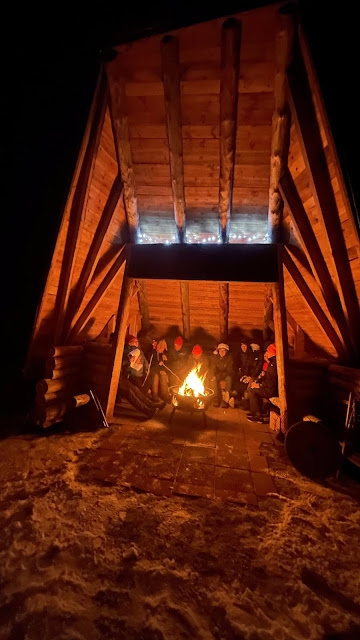
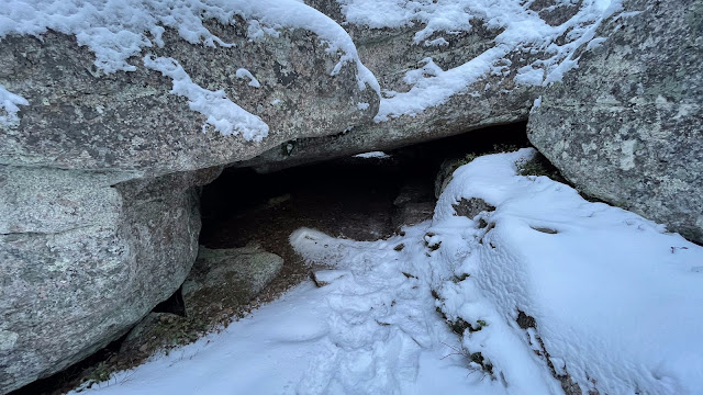
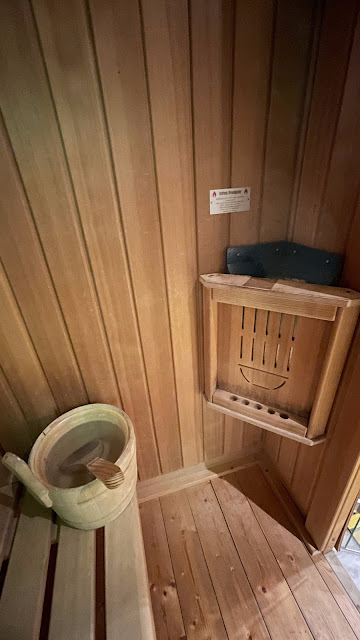
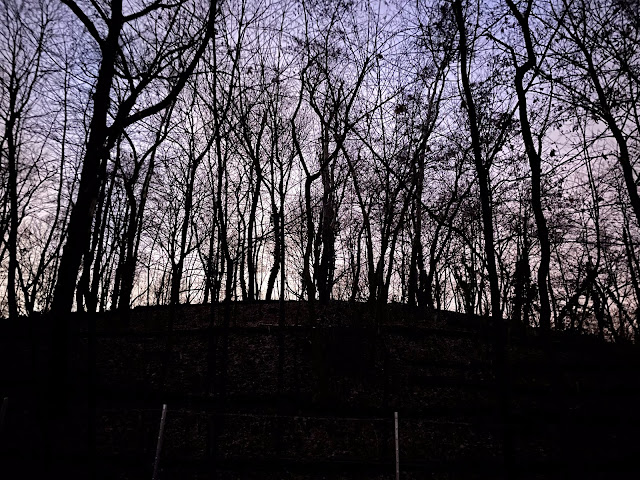
In August I visited Austria, and was able to hike to the Tischofer höhle and Hyänen höhle caves. Back then, I took 3D scans of the caves. Having worked with automatic construction of cave maps since then, six months later I'm now starting to have a capability to run these models through the Cave Outliner and get plan and cross section views out. Pretty interesting work, by no means done but lets see where this path leads us to!

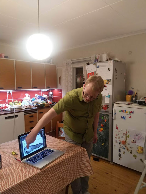
The basic idea is that one can scan a cave with the iPhone on site, which for small and moderately sized caves happens quickly. And then the resulting 3D model files can be exported to computer, and later processed by the Cave Outliner software to turn them into plan view maps and cross-section images, automatically. The software is not perfect, and neither are typically the scans, so typically some manual adjustments are necessary. However, what's nice about this approach is that it can very quickly produce very realistic shapes of the cave forms, including cross-sections from any number of points.

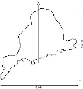
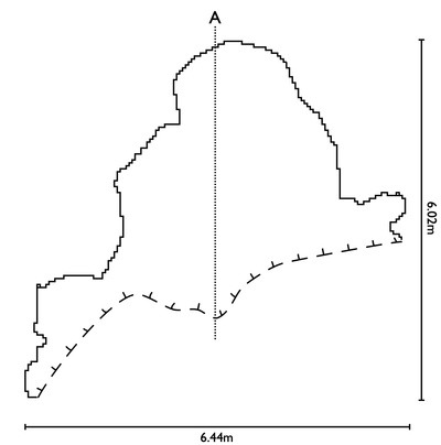
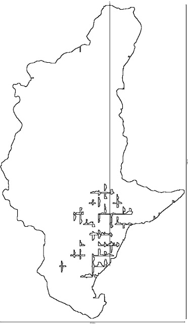
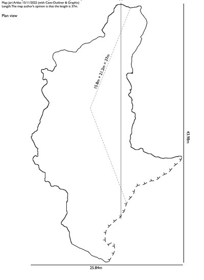
The generated plan view is above, some tidying was still needed, the final picture is below.  The full maps in PDF, including cross-sections can be found here and here.

The original view at the top has some artefacts that are based on the inaccuracies of the scanning or the sensor:

  • Not all surfaces have been adequately covered, perhaps due to too quick scanning, e.g., near the middle of the entrance to the cave.
  • The walls of the cave have a few mistakes, sudden pins going inside. These are the result of a scanning artefact messing up with the border drawing algorithm.
  • Due to the sensor range limitation (5 meters), the roof near the entrance could not be scanned, hence in the cross section the roof has been estimated. Lack of the roof also means that the usual algorithm for recognising entrances cannot be used in Cave Outliner. However, even when there is a roof (as in the Hyänen höhle), the algorithm is not yet perfect.

Those pictures were for the Tischofer höhle. For the Hyänen höhle they are here:


The 3D models can be looked at directly on your browser here or here. and downloaded from here or here.

This article has also been published at TGR. Read more urban exploration stories from theurbanexplorer.net, and other underground stories from planetcaver.net. Read the full Planetskier series at planetskier.net, or all blog articles from Blogspot or TGR. Photos and text (c) 2021-2022 by Jari Arkko. All rights reserved.

Deutsches Museum Flugwerft Schleissheim


I had not known about this: Deutsches Museum has a wonderful other side outside Munich, for aviation. 

Click here for the details.

But my favourite was this "airplane":

More flying stories at Planetflier.com. Photos and stories (c) 2022 by Jari Arkko. All rights reserved.


Großer Bunkerberg


Großer Bunkerberg is the name of the Berlin ruble mountain in Volkspark Friedrichshain. It housed previously one of Berlin's air defense 'flak towers', the Flakturm II G. Only a small corner of the blown up tower is still visible on the site, at the top of a large hill.

The coordinates are N 52.526380 E 13.432155. More information about this bunker is available from Wikipedia. And I've previously covered other, more intact flak towers in Berlin here.

Some more pictures here:


Berlin is also otherwise nice in the night:

Read more urban exploration stories from theurbanexplorer.net, and other underground stories from planetcaver.net. Read the full Planetskier series at planetskier.net, or all blog articles from Blogspot or TGR. Photos, videos, and text (c) 2021 by Jari Arkko. All rights reserved.