Sunday, October 9, 2022

October turns at the x-country ski hall


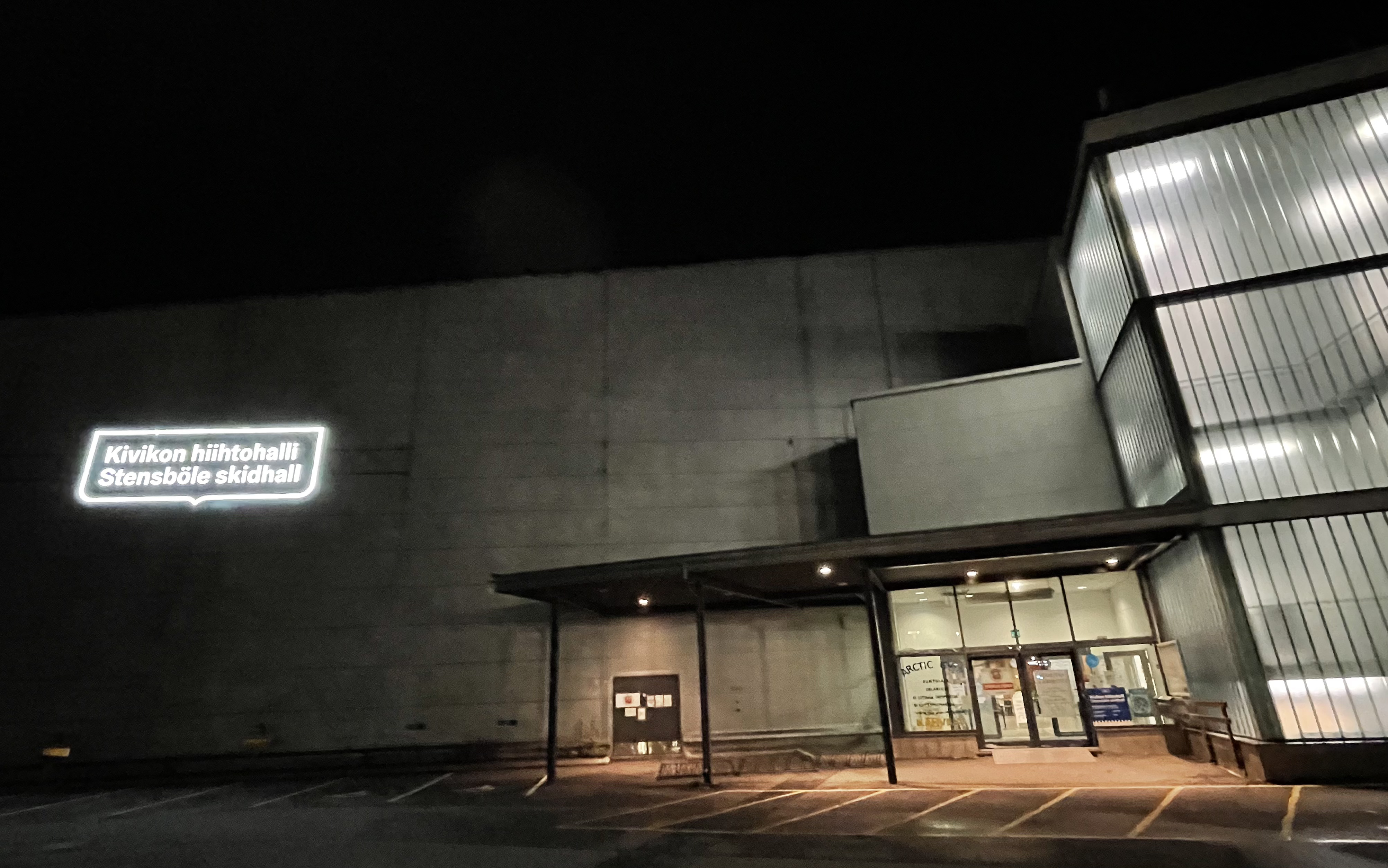
The city of Helsinki maintains a previously commercial Kivikko indoor ski hall. It has been scheduled for closing, however, due to rising energy costs and small number of users. Hopefully that decision can be turned! But. It is an *x-country* ski hall, how can one enjoy it for downhill skiing? To begin with, I was wondering if I'd be allowed in with my ski boots and alpine skis. But no one batted an eyelid... and I put them in touring mode, which made progress on the track nice. And then .. there is about a 4-5 meter slope along the track... I switched to "skating" mode and side of the track... voilĂ !

Video:

Ski hall building:


Inside:


The slope that runs between the two levels in the ski tracks:


Author:


Funny character:

This article has also appeared in TGR. Read the full Planetskier series at planetskier.net, or all blog articles from BlogspotTGR. Photos, videos, and text (c) 2022 by Jari Arkko.

Saturday, October 8, 2022

Lost River Caverns

On my work trip to Philadelphia, I also managed to visit the Lost River Caverns, an hour and half from the city. What a wonderful display of colors and cave forms!

The most interesting room that you can visit is the Crystal Chapel, a site of more than 100 underground weddings. And the site of dance parties in the 1880s... on a wooden platform (!). The room has some stalactites but is mostly covered with flowstone, including a massive light-colored flowstone area that one has to navigate around when moving about in the room.

There's actually another, even more interesting room but it isn't accessible for visitors, due to the access to it being most of the time under water. The Queen's Room was discovered only in 1963 during a drought.

Lost River Caverns is a Karst cave, i.e., limestone cave carved through chemical processes. The cave was discovered in 1883 and has been operated as a show cave since 1930. But the age of the cave is estimated to be 250 000 years. The cave length is 370 meters.

The cave has gotten its name from the small stream that runs through it, but neither its source or where it goes has not been determined.

Read more about this cave from their official website (also linked above), World of Caves website, and wikipedia. There's also a nice set of facts about the cave in this "teacher's information package" for the cave and the PA Bucket List website. The cave is in Hellertown in northern Pennsylvania (coordinates N 40.58081 W 75.33099).


Crystal Chapel pictures:


Other cave forms, including cave bacon and a helictite:


Cave passages:


The cave ticket hall has a large shop with a remarkable collection of memorabilia and souvenirs from rocks to photographs. And caving "helmets" for kids:


Overview of the ticket sales hall and shop:


Signs:


Read more urban exploration stories from theurbanexplorer.net, and other underground stories from planetcaver.net. Read the full Planetskier series at planetskier.net, or all blog articles from Blogspot or TGR. Photos, videos, models, maps, and text (c) 2022 by Jari Arkko. All rights reserved.

Tuesday, September 27, 2022

Taking the chairlift to September runs


I try to ski every month and September is always a difficult one. Today’s run was short, but with full service.

This article has also appeared in TGR. Read the full Planetskier series at planetskier.net, or all blog articles from BlogspotTGR. Photos, videos, and text (c) 2022 by Jari Arkko.

Sunday, September 25, 2022

Jabba the Hutt makes an appearance in a Philadelphia cave!

Crystal Caves here, there, everywhere! I had an uncanny feeling that I've been before to a Crystal Cave, but hey, everybody's entitled to have a crystal cave, no? And this everybody isn't just anybody, it is somebody. Jabba the Hutt, to be precise!

Crystal cave is a nice, spectacular and friendlily run show cave in Pennsylvania, about an hour and twenty minutes drive northeast from Philadelphia (see the google maps link). Their website is here, and the Wikipedia article has some more information. Admission on a tour is 19$.

Other Crystal Caves can be found from the Wikipedia list, as well as the one in California was described in my earlier article.

Jabba's body seems to have some medical issues:

And yet another view of Jabba the Hutt:

Here are some funny signs from the cave:

Main cave hall views:

And more beautiful cave forms:


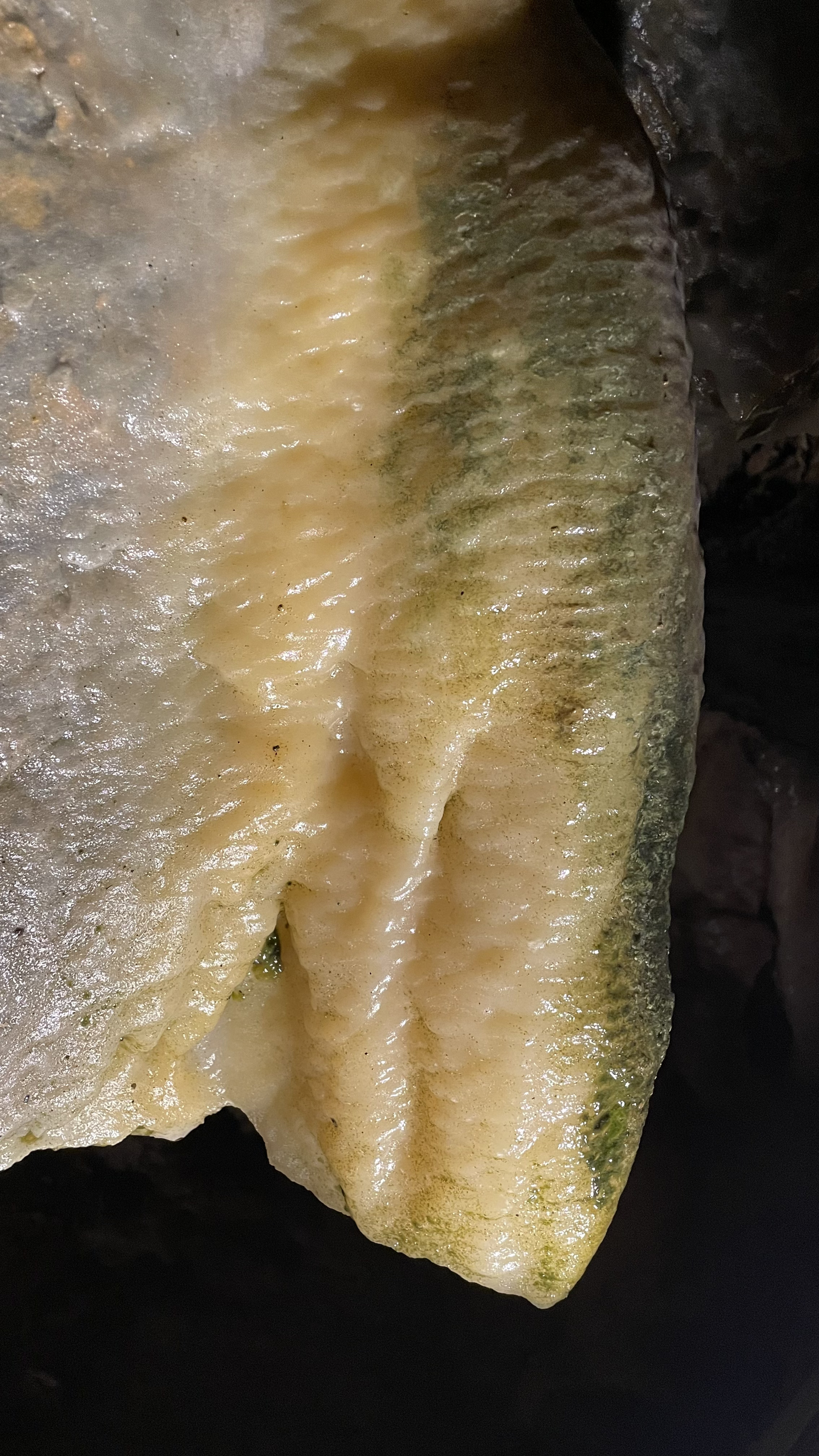
This form was remarkable, and it is not exactly know what happened here. No, it is not someone sticking a washing sponge or rice cookie on a stalactite:


The house outside the cave:

Read more urban exploration stories from theurbanexplorer.net, and other underground stories from planetcaver.net. Read the full Planetskier series at planetskier.net, or all blog articles from Blogspot or TGR. Photos, videos, models, maps, and text (c) 2021-2022 by Jari Arkko. All rights reserved.

Saturday, September 24, 2022

Kipontie, what a wonderful Finnish cave!


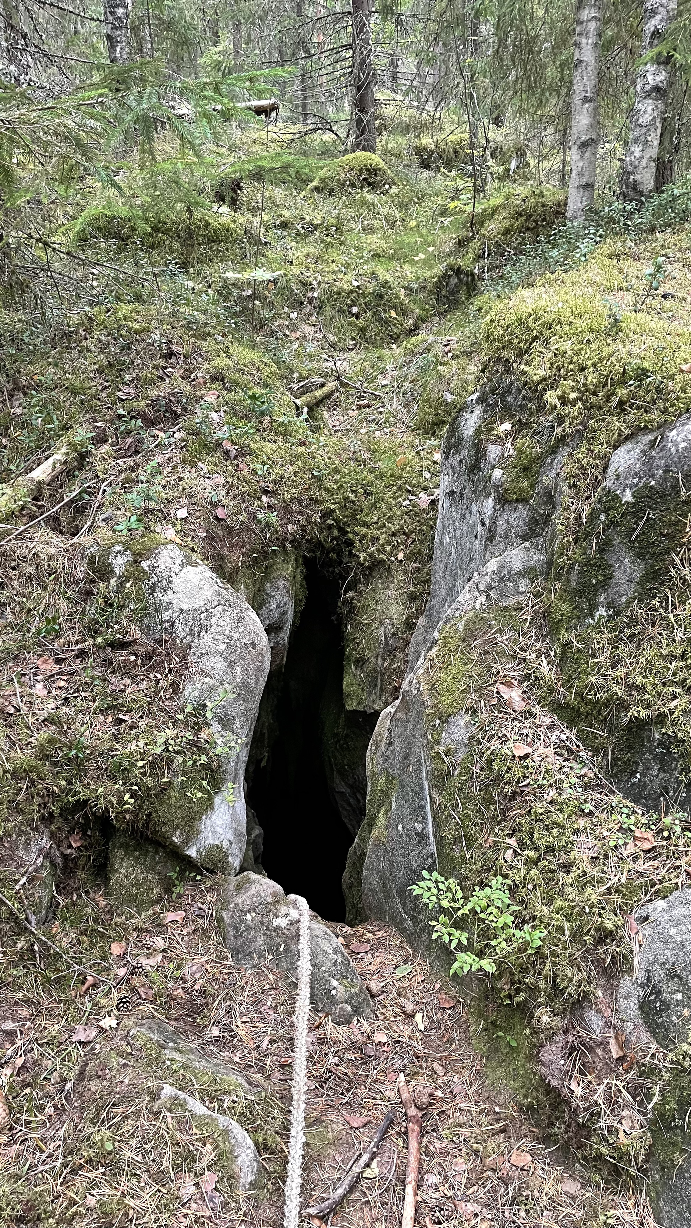
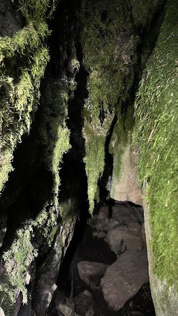
Why look for limestone caves and stalactites, when in Finland you can find moss-stalactites? And besides stalactites, the Kipontien luola (cave of the scoop road) is an exceptionally nice experience. Most Finnish caves are cracks on a cliff or space under boulders. But Kipontie is a hole in the ground, on a more or less level surface, even if inside you can see that it is made up of cracks and boulders. But it is dark, it is tight, actually make that very tight, and downright claustrophobia inducing hell hole. Just like caves should be!

Oddly enough, there hasn't been that much stories about this cave, I have not been there even if it is close to my summer cottage, nothing in Retkipaikka that I can find, and I have not heard about it in the Finnish Caving Association's discussions. In my mind this cave is such a challenging caving experience, dark, and long enough to warrant being compared to Turku's Luolavuoren luola (cave of the cave hill :-) ) or Finland's major karst cave, Torholan luola (cave of Torhola) in Lohja.

But yay, a few years ago Seikkailun lumous made a map of this cave [1]. Very nice! That map is further down in this article, but I used my 3D phone scanner to construct a new map. It is not easy to get a high-quality scan in very tight places, but I managed to get enough to run the model through my map generator, and got this:
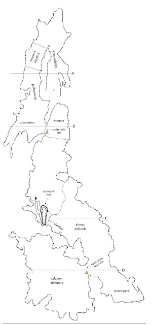
Based on the model, I also calculated that the cave is about 35 meters long, all parts considered. There's also cross sections in my map, such as this one about the Kuoppa (hole) in where the left passage of the cave goes down through a tight spot:
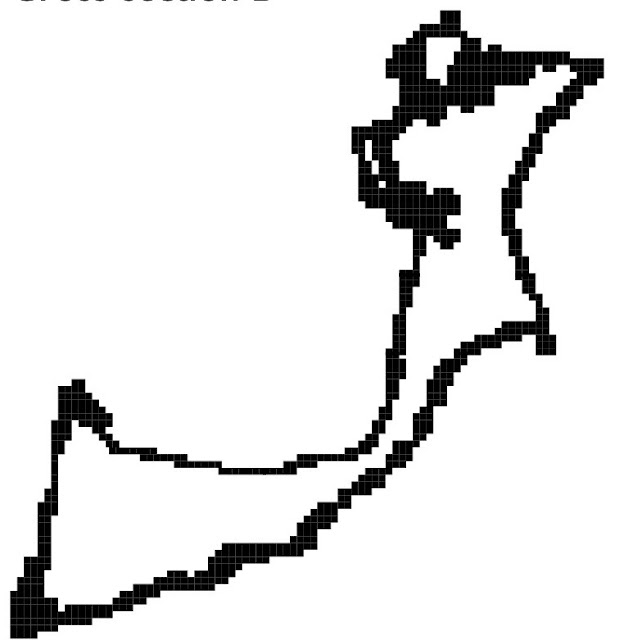

To make the model, we did crawl as far as one can to the cave, although I did not go to the Salainen alahuone (secret lower room) on the left side passage, the entrance to the room was too scary and tight. But my son did, so the 3D model is relatively complete.

The full map in PDF is here. The 3D model can be downloaded here or rotated on your screen here.

The cave is in Orivesi, and about 45 minutes drive from Tampere. The coordinates are N 61.685539 E 24.257283.

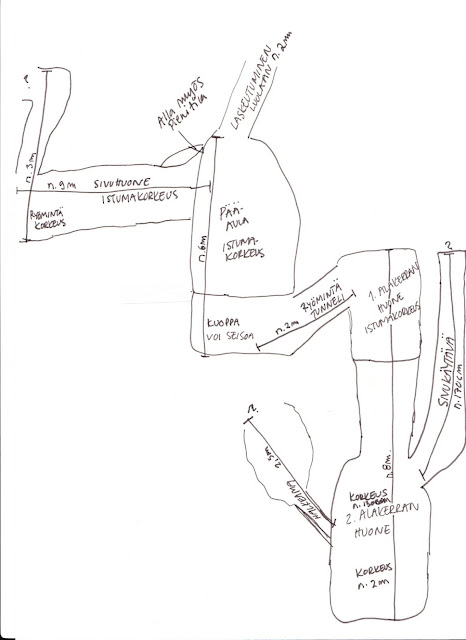
Here's by the way the Seikkailun lumous map, made by hand from measurements. I can't fully explain the difference to my map. I should note that the 3D scanner and softwares are quite experimental, and often seem to make mistakes or produce shadow results. But I also think that we covered bigger part of the cave. It is possible that some of the side passages either in the below map or our map are also errors. And since I have to for now construct the 3D model in parts, I can easily introduce alignment errors where the cave parts are not in the right angle against each other.
More pictures, first about the entrance:


An inside view, from the left passage and the Nouseva käytävä (rising passage):


The author, apparently looking for gold?


This is how kneepads should look like after caving:

References:

[1] Seikkailun lumous. Kipontien luola. Suomen luolaseura. Luolaseura.fi.

This article has also appeared in TGR. Read more urban exploration stories from theurbanexplorer.net, and other underground stories from planetcaver.net. Read the full Planetskier series at planetskier.net, or all blog articles from Blogspot or TGR. The Cave Outliner software is open source and available on GitHub. Photos, videos, models, maps, and text (c) 2022 by Jari and Janne Arkko. The Seikkailun lumous map is obviously from Seikkailun lumous and Suomen luolaseura. All rights reserved.

Sunday, September 11, 2022

Schraubenfallhöhle


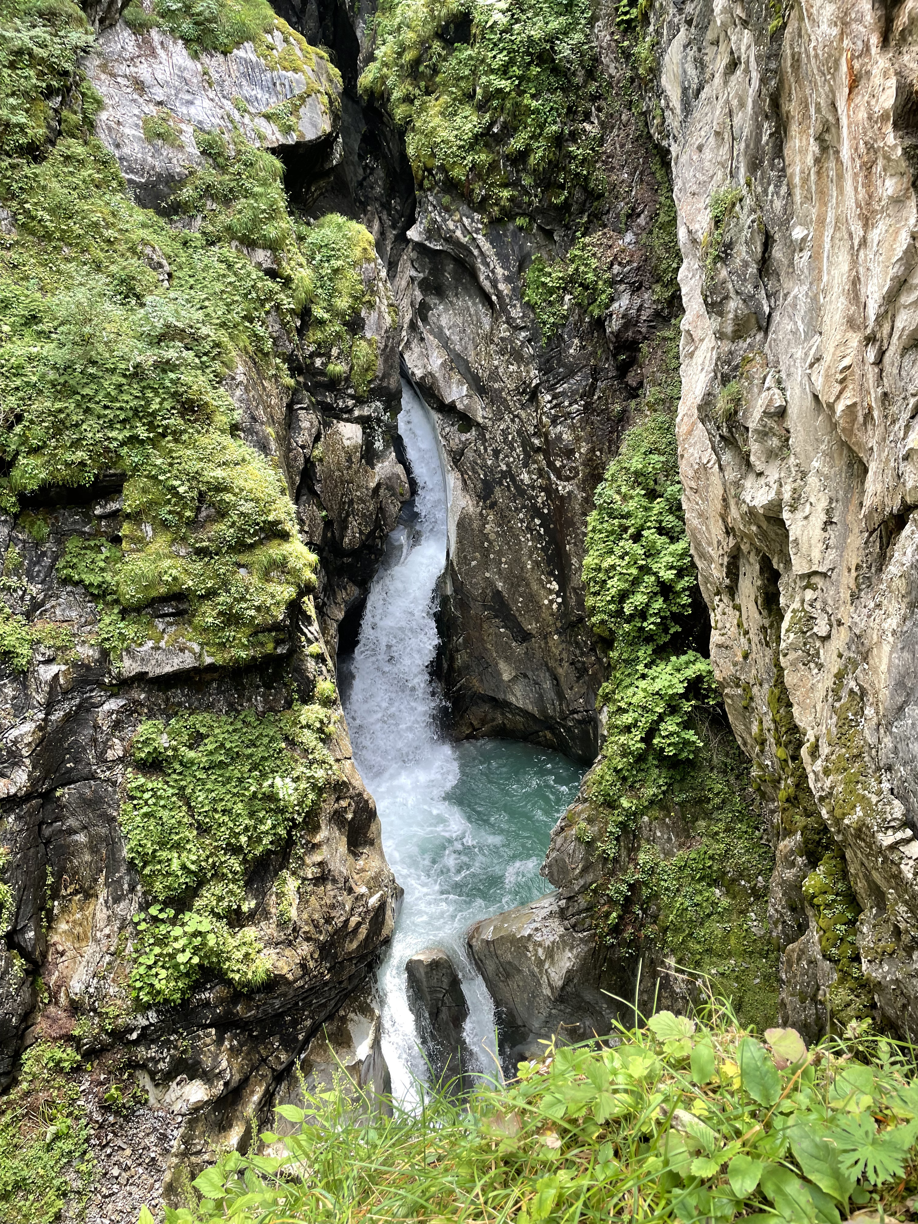
Schraubenfallhöhle is a cave, an underground river. It starts from one raging waterfall of the Tuxbach dropping into a wide hole in the ground, and emerges a bit later to start another waterfall. It is located by the end of the Hintertux valley, right by the lowest lift station taking people up to the Hintertux glacier.

You can read more about this cave (in German) from this research article, "Die Klamm des Tuxbaches bei Hintertux (Tirol) und das Alter der Schraubenfallhöhle", appeared in Die Höhle in 1967, issue 018. The article is by Hubert Trimmel.

Entering the cave is impossible, as it is maybe fifty meters down in a deep gorge. I'm not sure if the cave is otherwise visitable, perhaps during dry seasons and when not much meltwater is coming down from the mountains. The article referred to above seems to describe what's inside the cave, so people have been there.

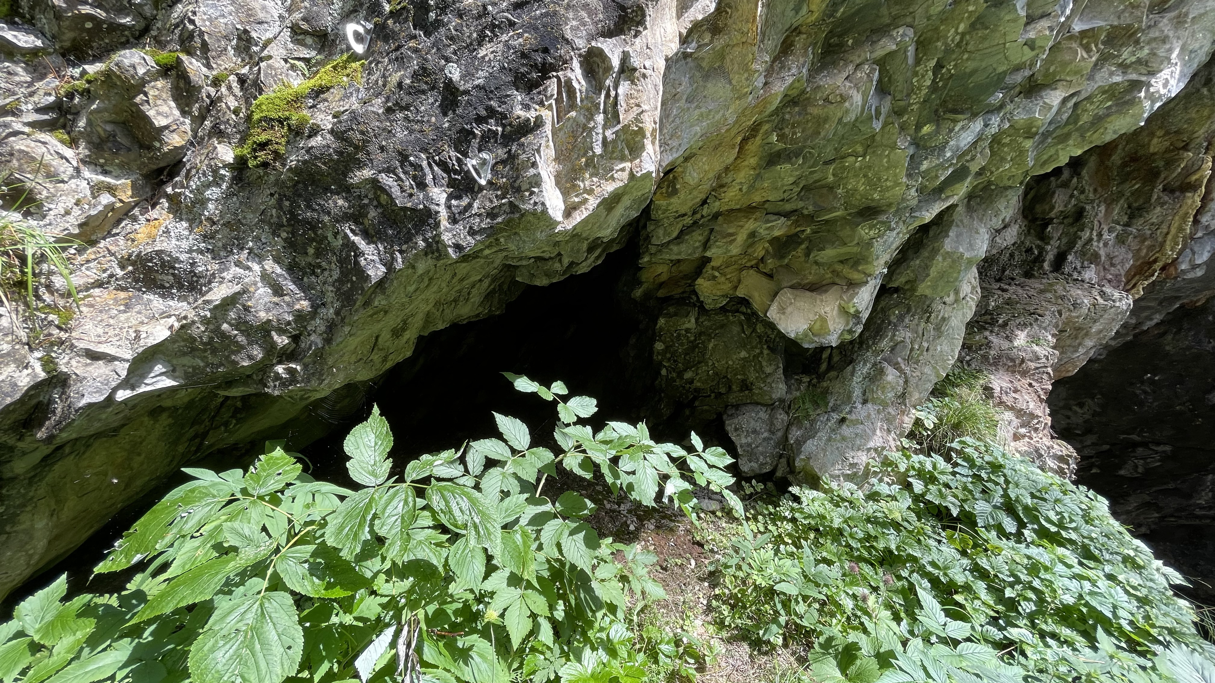
I was therefore not in the main cave, but visited a couple of tiny caves on the side, though Austrians would probably not call these caves at all. Just a few meters long, enough space for one person. The first side cave map is here, a rotatable 3D model here, and the model can be downloaded here. The second side cave map is here, a rotatable 3D model here, and the model can be downloaded here.

Video:

Views from the top waterfall falling into the cave:


Marble at the bottom waterfall:

Side cave 1:

Side cave 2:

Read more urban exploration stories from theurbanexplorer.net, and other underground stories from planetcaver.net. Read the full Planetskier series at planetskier.net, or all blog articles from Blogspot or TGR. The Cave Outliner software is open source and available on GitHub. Photos, videos, models, maps, and text (c) 2022 by Jari Arkko. All rights reserved.