
I had great plans, but they all failed. Either the caves I visited turned out to be man-made, they were too small and I had to let them go, I didn't find them, or I arrived to late and they were already closed. So much for my effort to visit five new caves on my way from the conference to the airport.
There's also some wonderful areas, full of holes in rocks... and look at some of the houses built in these areas, e.g., in the picture above.
Below are the caves that I visited, in what I think was sandstone in all cases:
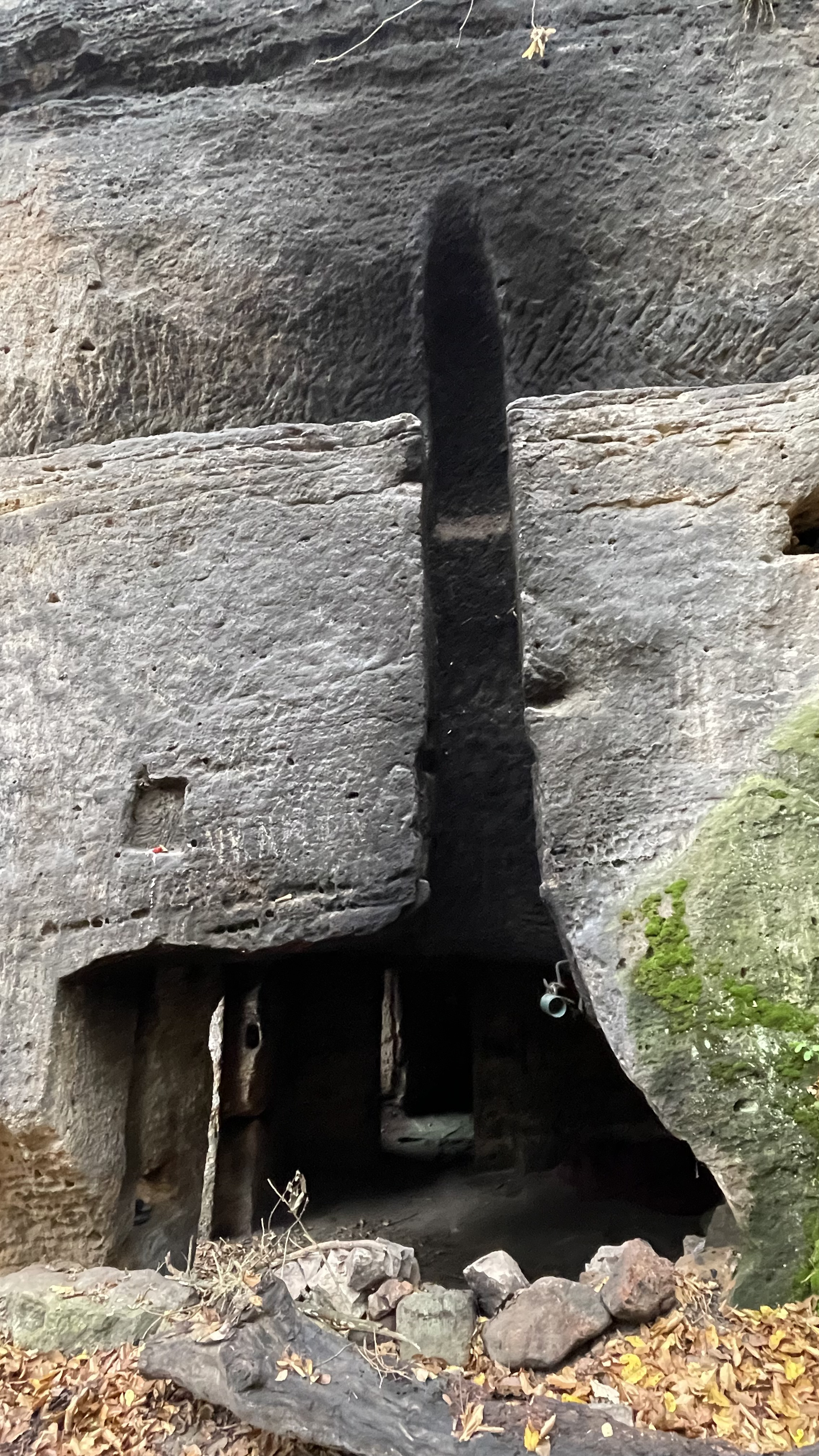
Jeskyné Klemperka, in Kokořín, Czech Republic. This is likely an originally natural cave that was significantly enlarged by man. The nice thing about this cave was that you needed a ladder to reach the entrance. One was provided. Nice! Coordinates: N 50.437637 E 14.554619.
The cave is on a crack in a ledge, but the cave continues directly into the cliff by one room which is probably man-made. The ledge was probably enlarged by man as well. Then there's stairs to a lower level which has one very large room. And apparently some bats, at least according to the sign.


Jeskyné Klemperka underground hole. A small pit, a hole under the cliff and under the ground level. Looks natural, not man-made. Maybe 2 meters long. Coordinates: N 50.438349 E 14.554954.


Jeskyné Klemperka side apartment. This fifty meters further north on the road and on the other side. It looks mostly man-made, though perhaps there's been a crack that they started enlarging. This is like a ground-level apartment with few small rooms. There was also a second level hideout inside the crack. Very small. Coordinates: N 50.438382 E 14.554900.


Kokořín shelter cave 1. Well this is entirely natural, but it is tiny, maybe 6-7 meters across and 2 meters under the roof. Coordinates: N 50.442271 E 14.552615.

Kokořín shelter cave 2. This is also entirely natural, a roof that has formed in front of a cliff, roughly half-way up but easily reachable. This is also maybe 6-7 meters long, and perhaps 3 meters under the roof. But a bit more open. However, there's a nice separate bolder sitting on the ledge, and holding the roof up. Coordinates: N 50.442155 E 14.552186.


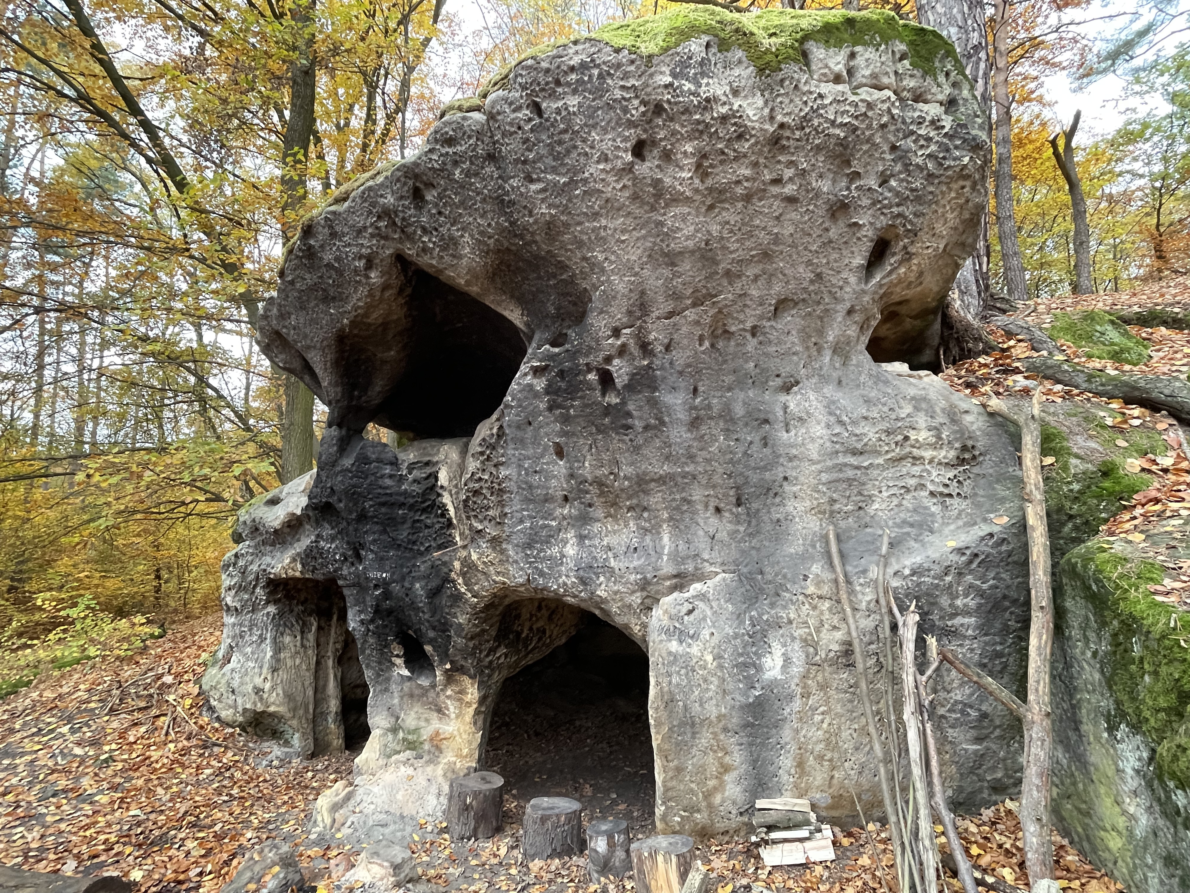
Jeskyné Rozbořenka. This is entirely man-made I think. A magnificent set of massive stone blocks, and then they've turned the lowest level of the blocks into apartments :-) Interesting, but definitely weird. And ... someone was living in there. Coordinates: N 50.443150 E 14.551614.


Jeskyné Wernerovka, Medonosy-Libéchov. Again, entirely man-made (except maybe for the little horizontal crack in the second level. A smallish rock outcrop made into a two-room apartment. Coordinates: N 50.502520 E 14.529695. Some articles: Kudyznudy, Navylet.

Wernerovka firepit shelter cave. There were a few cave-like things but too small near the Wernerovka cave. This one is a nice camping spot and a fire pit, right under a very high but shallow negative rock face. Not that I'd necessarily put any fire under any rock, even if the rock is high... rock cracks with heat. Coordinates: N 50.503227 E 14.531643.

Wernerovka mini cavelet. A little mini-canyon between two rock outcrops and some boulders on top makes for a small cave. Maybe 5 meters long. Access on a very steep dirt face covered by half a meter of leaves. Difficult to get in. Coordinates: N 50.502543 E 14.531230.

Konépruské Jeskyné, Konéprusy. A massive commercial cave. But I arrived twenty minutes after they had closed the entrance for the day. Oh well. Maybe next time. Coordinates: N 49.915136 E 14.067413. Read more about this from the official site or Wikipedia.

(The above photo is by Zp in Wikipedia)
Kodska Jeskyné, Srbska. On a very steep hill with thick bushes. I was unable to find it, despite circling around both of the coordinates that I knew about. Oh well. I might have found it with more time, but I felt uneasy about the hill and my descent from there; the whole thing was too steep really to safely be there, at least in the rain that was coming down. Slippery leaves. Coordinates: N 49.933078 E 14.125004 (Wikipedia) or N 49.932939 E 14.124656 (Google Maps). However, later I realized that the Tourismato site points the cave to a different side of the valley. Maybe those are the right coordinates?

No comments:
Post a Comment