Sunday, July 21, 2024

My first HEL-SEA flight


A route that I have not flown before, HEL-SEA. Finnair has been flying these on and off for a long time. Travel starts by the traditional praying of the sauna gods in the lounge. Maybe that will help with the short connection on the next leg. Relaxing, at least.

At the airport lounge I also took again one of the "beyond meat" burgers, really good! Really enjoy the Finnair non-Schengen platinum lounge, sad that I won't be able to use it much longer as I can't maintain my status with current number of flights I'm taking.

I managed to get a (small) upgrade to an economy extra seat in the Finnair plane. Nice, the seats are slightly wider so that I can actually fit in. Used my two last Finnair European vouchers to do that. To my surprise we also got one of the Finnair's Marimekko pouches with earplugs, eye covers, etc. on these seats. Nice touch.

I happened to be sitting also next to the captain's spouse, who was both fun to talk to, and had all kinds of goodies brought to her by the crew. Nice :-) 

SeaTac, or the Seattle-Tacoma International Airport is a wonderful, large airport serving the two cities and a major hub for a number of airlines. Such as Alaska Air that I took from Seattle to Vancouver. Vancouver's airport is also quite nice. I was struck by how easy immigration processes and security checks were in both. Very efficient. 

Both airports have also significant on-airport commerce, shops, etc., far more than what one is typically used to in North America. Well done!

But ... no sauna. What's up with that? Don't you see the benefits of having a sauna in your lounges???

Helsinki:


Seattle:


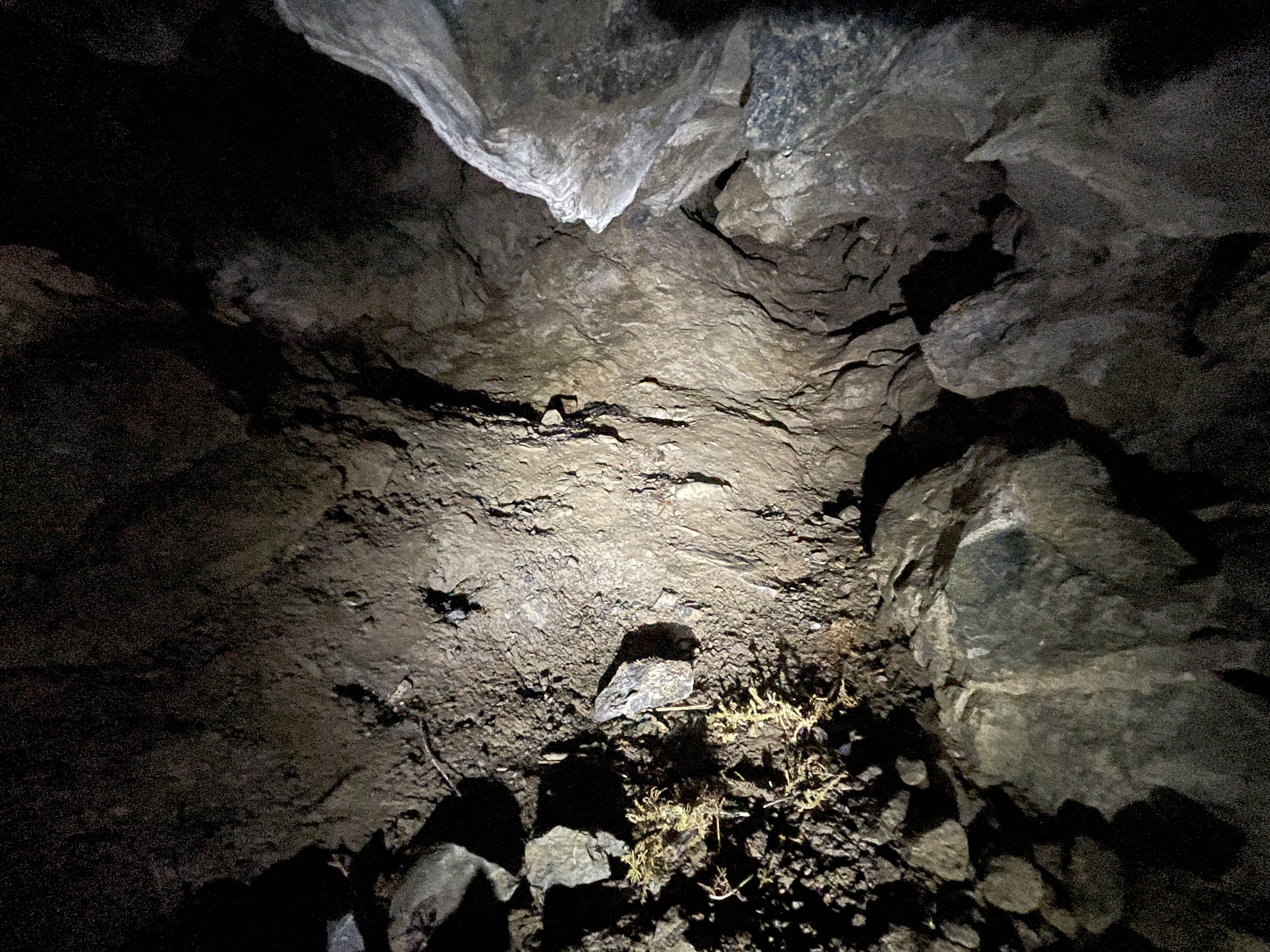
Weirdly enough, with all the effort of getting from Seattle to Vancouver, I rented a car and immediately drove across the border: The goal was to get to a cave and ski hill visit on the US side. Surprisingly, it was super smooth to cross the border again. Nice artwork also on the US side, in sunset light:


For more flying stories, check out the planetflier.com website! or more sauna and swimming stories, check out planetswimmer.com and saunablogger.cool websites! And of course the Planetcaver, and Planetskier blogs for other stories in Blogspot and TGR! The photos and text (c) 2024 by Jari Arkko. All rights reserved. I never take photos of other saunagoers or swimmers. and try to visit at times where there is simply no one else around or the facility has been booked only for me.

Mt. Hood Summer Skiing


TBD...

Mt. Hood’s Timberline Lodge is the only (I think) open summer ski resort in North America. Wonderful, good snow and more than 800 meters of vertical in summer! Plenty of out of bounds, too. July skiing: check.

Read the full Planetskier series at planetskier.net, or all blog articles from Blogspot or TGR. Photos and text (c) 2024 by Jari Arkko. All rights reserved. 

Chilliwack River Caves


Fail. I did find a cave, a small one, but I only later learned there would have been a much bigger cave higher up. And the other cave I was searching for ... I could not find. I guess the coordinates were wrong. Oh well, it was a nice outing by the riverside. 

I was in Fraser Valley, near the town of Chilliwack and following the river Chilliwack. This area is about 40 kilometers east of Abbotsford, a cheap place where I was staying while waiting for my conference hotel in Vancouver to have free rooms. (See my other article about swimming in Abbotsford's hotel.)

The cave that I was here to look -- the Slesse Creek Cave -- at was understood to be small, but I was surprised how small it was, just maybe an 8-meter hole by the road. It is under a large cliff that rises straight from the road. A bit further to the west from the cave there's a place where climbers climb on the cliff face. 

Still, a nice little cave to crawl into. Slightly muddy, plenty rocky bottom and low ceiling. Which was challenging with my knees that are not in so great shape. Oh well.

But later I learned that there's a bigger cave about 100 meters higher up the steep hill/cliff, according to this link (BrmpMaps) and this discussion (ClubTread). Sad, but on the other hand I would not have had time or energy to climb much that day, and it isn't clear there's a way up easily.

What made the situation difficult also was that there was no Internet in this area, so I could not check pictures or other articles about the cave. 

This lack of Internet turned out to be more serious as I drove couple of kilometers more east to look at another cave, the Chipmunk Caves. There's a very nicely marked parking area by the road for this cave. And one has to walk half a kilometer on paths to the river side where the cave's location was supposed to be. But, I found nothing. Scrolled through the forest back and forth, paths and off paths. Nothing. Not even any rock or cliff that would enable there to be a cave. I also checked the river bank. And the other side river bank, though crossing might not have been possible. Nothing.

Wrong coordinates? Maybe. Again, not having the Internet lead me to not be able to look for other coordinates. So I drove back to work and back to my hotel.

More information:

Slesse Creek Cave link that I learned about is here (Google Maps). It just pointed to the holes by the road. Chipmunk caves are described here (Google Maps, the link I used) and here (TripAdvisor). There's also information here (AllTrails) and here (AWalkAndALark).

Coordinates for the Slesse Creek Cave are  N 49.077442 W 121.710871. And the claimed coordinates for the Chipmunk Caves are N 49.105453 W 121.640650.

Slesse cave:


Slesse cave area. Here you can see the beautiful river, the climbing area, and some of the other cave-like holes:


Chipmunk caves area photos are below. Here you can see how well the parking was marked! But again, it was impossible for me to find the caves. Thick forest, beautiful forest, beautiful river, but ... no cave. 


Read more urban exploration stories from theurbanexplorer.net, and other underground stories from planetcaver.net. Read the full Planetskier series at planetskier.net, or all blog articles from Blogspot or TGR. Photos and text (c) 2024 by Jari Arkko. All rights reserved. 

Abbotsford Clarion Swim


Clarion hotel and conference centre is out of the way of the centre of Abbotsford, but conveniently located near the highway. I stayed here on a business trip because for one night there was no availability in Vancouver where my conference was. Or the prices were too high, north of 400 euros.

Of course I had to try to their pool. I was kind of expecting an outdoor pool, but no,.. an indoor one. A medium sized pool and a small jacuzzi. Not bad, but I wanted also a sauna, which wasn't there :-) Oh well. 

I also ate at the restaurant, had the crispy prawns and cucumber - watermelon drink, was quite good!


Interestingly, the hotel room had a gas-powered fireplace which turned itself on automatically if you adjusted the room thermostat. Nice!


The hotel felt like a highway-locked place where you can't really exit on foot. But if you walk past the fire station behind the parking lot, you can find a shopping area with interesting shops, like the Angry Otter Liquor:

On the way here, I also dropped by some caves in Fraser Valley. See the other article.

For more sauna and swimming stories, check out planetswimmer.com and saunablogger.cool websites! And of course the Planetcaver, and Planetskier blogs for other stories in Blogspot and TGR! The photos and text (c) 2024 by Jari Arkko. All rights reserved. I never take recognisable photos of other saunagoers or swimmers. and try to visit at times where there is simply no one else around or the facility has been booked only for me.


Saturday, July 20, 2024

Yale Park Swim

Yale Park is a recreation area by the (artificial) Yale lake in the Lewis River valley. The nearest town is Cougar. The park is part of the agreement for building dams on the Lewis River, and the area is maintained by Pacific Corp, the owner of the dams.

Quite nice. And with a view of Mount St. Helens! 

It was a refreshing swim after that sweaty cave hike that I did earlier. I was expecting the water to be cold, but it wasn't.

The bottom of the lake though is quite rocky, even massive boulders hiding just underneath. Be careful.

The park entrance is free, except on Friday through Sunday during the summers when you have to pay a small fee for vehicles ($4). The official page of the park is here. Fees are described here

Note that there's a string of these recreation areas along the river, including overnight camping places. Yale Park does not have that.

Photos:


Information sign:

For more sauna and swimming stories, check out planetswimmer.com and saunablogger.cool websites! And of course the Planetcaver, and Planetskier blogs for other stories in Blogspot and TGR! The photos and text (c) 2024 by Jari Arkko. All rights reserved. I never take recognisable photos of other saunagoers or swimmers. and try to visit at times where there is simply no one else around or the facility has been booked only for me.

Ape Cave: Lava Tunnel Adventure by Mount St. Helens

Ape Cave. Named after the scouts helping to explore the cave, back then called the "cave apes". One of my most amazing cave experiences. This cave is easily and safely accessible by anyone -- as long as you register yourself and your vehicle for the visit at the US Forestry Service. In the cave you can do just a small peek underground or walk 1 km to the nearest end of the cave on an easy path. Someone was even pushing strollers. And then you walk back the kilometer to exit. But you can also keep walking also to the other end of the cave, and then exit from the other exit. This is what I did, and that's a whopping 5.5 km walk underground. The cave is the third longest lava tube in North America. And with such amazing sights, e.g., the one in the picture above. Much recommended!

The cave itself is only 2.5 miles or 4.0 km, but since the main entrance is not at the end of the cave, you'll have walk an extra kilometer, as the entrance - end trip will be walked in both directions. Similarly, the other end is not at the end of the cave either, hence the 5.5 or so kilometers. The main entrance is near the parking lot and shop, but if you do the longer trip you'll be walking above ground on a nice trail back to the parking lot (around 3 kilometers). Along that trail there are some additional smaller lava caves, some of which you can enter.

There are only two entrances, but somewhere in the middle of the cave there's an additional hole with light shining through, shown above.

Lava tubes can be extremely beautiful, as the rock shapes are often smooth and interesting, and colors magnificent. The green mossy surfaces where light gets through, but the red, black, brown, yellow, orange, gold... everything! Some examples:

The shapes are generally tube-like and flowing. Like here, reminding me of a cathedral shapes:

Often there's also ripple and wave effects from the lava in surfaces. And sometimes you can see evidence of multiple levels of flows, like below:

The detailed on the surfaces is also super interesting:

The longer end-to-end route is not for strollers, though. Along the route there will be 27 breakdown piles (mountains of boulders from rock collapsed from the roof. These are not easy to cross, you'll have to be careful with your steps. I should say though that when I was there, I was followed by maybe five other groups of people going through the cave, and one of them had a maybe 3-4 year old kid with them. I can't imagine how he got through it, maybe by being lifted by his parents.

There's also a crux in the tunnel, a 3 meter lava "waterfall" that you have climb up. This is warned about in materials about the cave. 3 meters doesn't sound like a big problem but of course since it is vertical you have to get up or down it, and some information I had was that there wouldn't much hand or footholds, or any other assistance. Hence I was a bit apprehensive about this, particularly since I was alone, but of course I could turn back if crossing turned out to be impossible for me. It turned out that there was a rope, too, installed by someone. But you didn't even need the rope, because the lava surface had more than adequate handholds to pull yourself up. I'm usually a timid climber in these situations, but I had absolutely no problem. 

One thing that should be observed though is that going up is easier than going down. Hence it is better to cross the cave from the main entrance onwards than the other way around. But of course if the rope is still there, then even coming down will be easy.

Here's the crux, pictured from above:

And from the bottom:

A famous part of the cave is on the easy 1-km hike, the "meatball", a rock hanging between two sides. Pictured here on the cover a brochure:

To register for the hike, go to the US Forestry Service site, that has instructions on what to do. They will redirect you also to recreation.gov for the actual payment, which is only 2 $. Note: it is not super clear in the websites, but you also need a Northwest Forest Pass, America the Beautiful Pass, Day Pass, or National Forest Recreation ePass. These you get from discovernw.org site. That ticket price varies on what you get, but the one day ePass is 5 $. Cheap by any standards, but you'll need to print these on paper before entering the site. Note that the Ape Cave tickets are timed on two hour slots. However, on site there's no checking so if you arrive a bit early or stay longer (as I did) it is no problem.

Visits to Ape Cave are only possible in the summer, May 18th to October 31.

The main entrance is with easy stairs, but the other entrance is is with a ladder:

The cave should of course be kept pristine. So don't touch anything you don't absolutely need to touch, don't break anything, don't bring anything that might become trash or bacteria in the ecosystem.  

And remember to clean your shoes well before and after visits, to avoid spreading white-nose syndrome or other bat diseases. I actually always wash my hiking shoes in very hot water to avoid carrying anything from cave to cave:

More pictures of the light opening in the middle of the cave:


Other small caves along the surface:


More pictures from inside the cave:


The easy end of the cave is here, the one which is 1 km from the main entrance. Once you crawl over the little hump in the picture, you'll be in the last, small room that you have to crawl in. But based on the smell... someone had peed in it. Yeww.


I made a small cave 3D model of the area around the light hole in the middle of the cave:


The model can be downloaded here and rotated on your screen here.

Cave maps:


The high-resolution version of the map is available here.

More information about the Ape Cave can be found from the US Forestry Service site, Washington Geotourism website, Washington Trails Association's page, and Wikipedia.

Read more urban exploration stories from theurbanexplorer.net, and other underground stories from planetcaver.net. Read the full Planetskier series at planetskier.net, or all blog articles from Blogspot or TGR. Photos and text (c) 2024 by Jari Arkko. All rights reserved.