As part of our exploration trip to the Njiellalanjávri area, we scouted all signs of limestone around lakes Njiellalanjávri, Toskaljärvi, Veajetjávrrit, and Láfoljávri lakes, and the mountains in between. In some cases limestone was easy to identify, known to be limestone, in other cases it was not so easy to identify by non-experts. But we think we made a reasonable analysis, and found quite many places where there is at least potential limestone. There's plenty of loose rock pieces that are clearly limestone, but the more interesting target for us were ground rock layers. Or larger collections of potential limestone rock pieces that might indicate a ground rock layer would be somewhere nearby.
This is a long article. I should begin by saying that what's discussed here is the joint work between Duncan Simey, Jarmo Ruuth, and myself. I should say that none of us are geologists, we are just hobbyists.
There's of course research on this by Finnish geologists and the geology research institute. Jyrki J. Lehtovaara 's report, "Kilpisjärven ja Haltin kartta-alueiden kallioperä" from 1995 is the best source we have identified. It states:
"Nykyasemassaan epäjatkuva dolomiittikerros esiintyy hyvin monissa kohdin lnhella Jerta-laatan yläkontaktia. Sen paksuus vaihtelee nollasta neljäänkymmeneen metriin. Dolomiittikerros on ilmeisesti käyttäytynyt muita kivilajeja plastisemmin laattojen liikkeen puristuksessa. ja siksi se on paikoin paksuuntunut ja paikoin hiertynyt pois kokonaan. Dolomiittia ei missään kohtaa ilmeisesti ole kuin tamä yksi kerros."
That is, there's a layer of dolomite in the Käsivarsi area, with depth ranging from zero to forty meters. The layer has acted more plastically than other layers, and is at places thicker or thinner. There is only one layer at one one place.
Dolomite is a stone closely related to limestone, but slightly harder. Read the wikipedia articles here and here.
Here's the area our expedition looked at, between the Nijellalanjávri and Toskaljärvi lakes:
Here's a map of the locations where we found potential (by no means verified) limestone or dolomite:
The above map is also available as a google maps collection (click here).
Here is a description of the locations, along with pictures and coordinates:
1. Njiellalanjávri beach
Coordinates: N 69.230156 E 21.417171
On the lakefront of the Njiellalanjávri there's a large number of large boulders that (we think) are clearly limestone - or perhaps even some softer form of the rock, the smaller ones seem very soft. While the beach is covered with the loose boulders piled on top of each other, we believe that right behind the boulder field there are parts of more stationary, ground rock visible. These rocks are where the green grass turns into the rock field.
Here's a picture:
There's also a 3D model:
2. Njiellalanjávri field depressions
Coordinates: N 69.229934 E 21.414388 and N 69.230465 E 21.413774
There are several small and medium-sized depressions in the area. Often with rocks visible at the very bottom. Are these small sink-holes, or why did they form?
3. Njiellalanjávri rock outcrop 1 (smallest one, viewed afar)
Coordinates: N 69.228108 E 21.413636
There are four rock outcrops in the hill rising from Njiellalanjávri northwest towards Láforvárrit and Láforjávri. They are roughly in line with each other, presumably part of the same rock layer.
The first one is small. Actually it comes in two separate parts, a slightly lower and bigger (left in the picture below) and the a higher but tiny (right in the picture):
4. Njiellalanjávri rock outcrop 2 (largest one)
Coordinates: N 69.228234 E 21.409716
This is largest outcrop on the hill. It comes in two parts: the lower part does not appear to be limestone or dolomite. But the upper part and the broken rocks both sides seem to be. The upper part also exhibits some small forms that look like limestone has weathered over time: round holes, smooth surfaces.
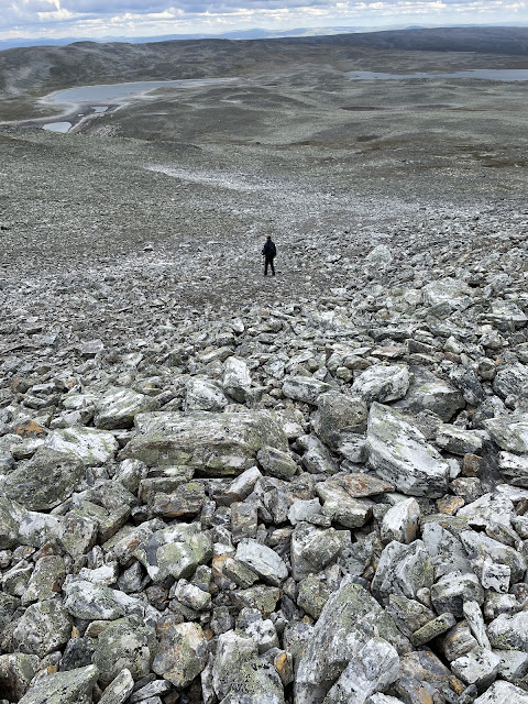
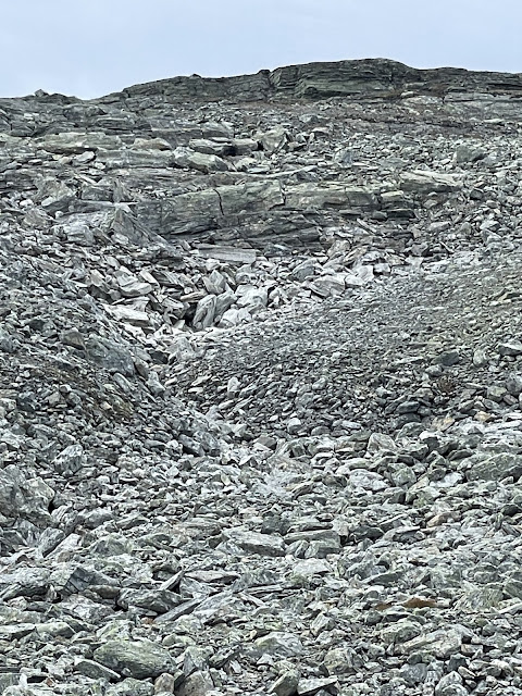
It is also interesting to look at the broken rock flows. As if something broke up higher, above the current outcrops, and then fell as loose rock in a "river" flowing down almost to the lake. When viewing the rocks above the higher outcrop in the picture, we found several rocks that could be part of ground rock layers, and not just boulders.
5. Njiellalanjávri rock outcrop 3 (another big one, viewed afar)
Coordinates: N 69.229532 E 21.407979
Here you can see the location of outcrop 3 above lake Njiellalanjávri:
6. Njiellalanjávri rock outcrop 4 (another small one, viewed afar)
Coordinates: N 69.229701 E 21.406723
See the above image for its location.
8. Láfoljávri rock outcrops
Coordinates: N 69.231713 E 21.378216
9. Láfolvárrit peak rocks
Coordinates N 69.221383 E 21.399812
At the very peak (or at least where there's a metal rod drilled into rock) the few large rocks appear to white-ish. Limestone?
10. Láfolvárrit rock stripes
Coordinates: N 69.222488 E 21.403918
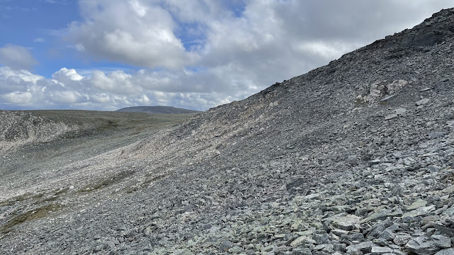
Below picture shows a view from the peak, walking down towards Njiellalanjávri. The strip of white-ish rock runs from the top and connects to another stripe that runs between the col towards Njiellalanjávri (left in the picture) and the ridge that runs southeast from Láfolvárrit peak.
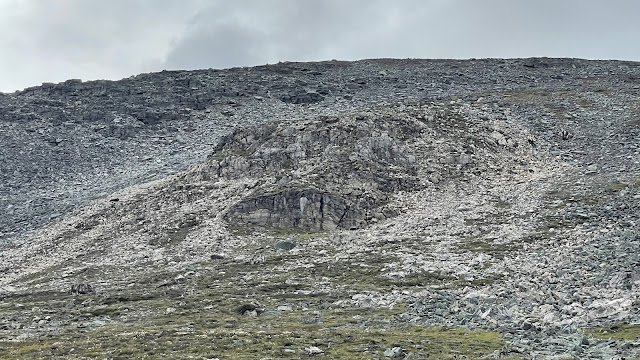
Another two pictures, now from lower down. Láfolvárrit peak is at the top, and Njiellalanjávri is to the right:
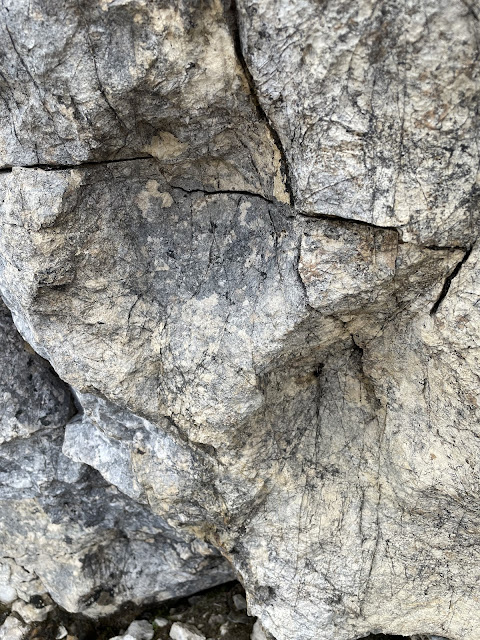
Detail of the rock:
There's another theory as well, however. We noticed that on Google maps satellite picture, the late snow patches seems to match roughly where the whiteish rock stripes are. Could snow be causing different moss growth or other reason that makes these rocks appear whiter? But the above rock does look like limestone...
This same situation appears with many of the places we looked at, by the way. For instance the same snow cover situation appears also on the Veajetjávrrit ridge and riverbed.
11. Láfolvárrit east ridge cliff 1
Coordinates: N 69.214497 E 21.442714
Close up:
12. Láfolvárrit east ridge cliff 2
Coordinates: N 69.215590 E 21.435341
This is further northwest from the previous wall of the same ridge. We were unsure about the rock, but the bottom layers in this picture are clearly different from other rock in the wall:
13. Láfolvárrit east ridge stream
Coordinates: N 69.217381 E 21.433211
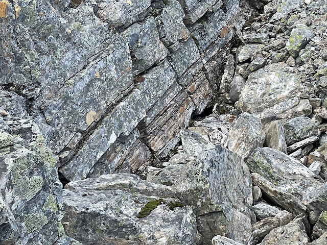
Flowing down from a small "caveat" there's a dried-up river in the ridge. Uncertain if the rock is limestone, but some of it is quite white:
14. Veajetjávrrit rock depression
Coordinates: N 69.221026 E 21.461596
On the Veajetjávrrit lakes there are some areas that look like depressions, with very limestone-like rock in them:
Here's a detailed picture of one of the rocks:
15. Veajetjávrrit ridge (viewed afar)
Coordinates: N 69.212658 E 21.470630
On the south end of the Veajetjávrrit lakes there's a rising ridge, with some white-ish colored rock. We have not been to the site itself, so cannot say what type of rock it could be.
16. Veajetjávrrit riverbed
Coordinates: N 69.214315 E 21.459706
Near an interesting (but not limestone) canyon, there's a dry riverbed. In some places there's what clearly looks like large boulders of limestone:
17. Toskaljärvi underground river
Coordinates: N 69.197457 E 21.440669 (sink) and N 69.196652 E 21.441825 (resurgence)
The Toskaljärvi underground river clearly goes into limestone rock. Here's the sink:
And resurgence:
18. Toskaljärvi underground streams
Coordinates: N 69.198256 E 21.435910 and N 69.198329 E 21.436235
Duncan spotted a few smaller underground rivers or rather streams, near the bigger underground river. We suspect the whole area of the field by the lake is made up of limestone rock.
19. Doskálhárji (not visited)
Coordinates: N 69.197870 E 21.492344 (location uncertain)
As Lehtovaara's report states:
"Maksimi paksuus esiintyy heti Toskaljärven idänpuolisessa pahtatörmässä Haltin lehdellä (1842 07B)."
That is, the maximum depth of the dolomite layer in the Käsivarsi area is in the hill right to the east of Toskaljärvi lake.
We do not have a picture of this.
20. Saana (viewed afar)
Coordinates: N 69.041185 E 20.850932 and N 69.038581 E 20.848430
This was clearly visible as we flew by Saana on our helicopter flight. As Lehtovaara's report states:
"Dolomiittia ei missään kohtaa ilmeisesti ole kuin tamä yksi kerros, ja siten Saanan etelärinteeltä maantiellekin näkyvä toinen, alempi yksittainen dolomiittipaljastuma lienee talusrinteessa alaspäin vyörynyt jättilohkare. Karttaan se on silti merkitty omalla kivilajimerkinnallään."
That is, he believes the lower dolomite occurrence (bottom left in the picture below) is a large boulder broken off from the actual dolomite layer that is under the top crust (top middle in the picture).
Read more urban exploration stories from theurbanexplorer.net, and other underground stories from planetcaver.net. Read the full Planetskier series at planetskier.net, or all blog articles from Blogspot or TGR. Photos and text and coordinates (c) 2023 by Jari Arkko, Jarmo Ruuth, and Duncan Simey. All rights reserved. Map base is from Maanmittauslaitos per CC BY 4.0, modified with the markings.









No comments:
Post a Comment