Sunday, November 5, 2017

Collapsable Cowshed


An abandoned cowshed? Or abandoned building to store abandoned cars? Not sure. But it is for sure about to collapse. The concrete looks very shaky. We were on top of the building before realising how sketchy this was.

Oh well, once we were standing on a relatively firm feeling spot, we decided to fly some drones. And hitting the brick walls for 2 out of 2 tries.... One drone continued to fly the other one needs some new parts.

Due to the sketchiness of this place, I'm not releasing the coordinates. Somewhere in Kirkkonummi though.


Photos and videos (c) 2017 by Jari Arkko and Olli Arkko. All rights reserved.

Saturday, November 4, 2017

GoExpo: Freeskiing, Nalle Hukkataival, and Catherine Destivelle


I visited the "GoExpo" this weekend, the merge of previously separate Vapaalaskuiltamat (Freeskiing Festival), Helsinki Adventure Night, and SkiExpo.

Pretty good setup overall, but all together, but in the end I got a bit tired for sitting in the movie theatre for so long :-)

There were some remarkable programs though. What stood out for me at least was the movie on Nalle Hukkataival's "Lappnor Project", the world's most difficult boulder route, grade 9A. Great piece on stubbornness for four years, attempting to climb mere four meters... and finally succeeding.

The other really remarkable piece was talk by Catherine Destivelle on her climbing career. Amazing, and to a large extent scary stuff. This was Catherine's first visit to Finland. Glad she came, very interesting talk!


Photos (c) 2017 by Jari Arkko. All rights reserved.

Thursday, November 2, 2017

Blasted Big Bunker


Today's article is from this blog's guest writer and my good friend Jarmo:

There was snow and rain, kids did not want to join and I had a schedule mismatch with Jari so I decided to stay at home. But after a while I figured that it would be nice to do some Sunday walk in the forest anyway. From local orienteering club Lynx map I had checked a bunker with an interesting description, "blasted big bunker".

The place was clearly visible in old aerial photographs from 1956. So I decided to go and check it, if it turned out to be interesting we could go again to explore it better. Coordinates are: N 60.152900101309356° E 24.449490859745083°.

I approached the place from the west to avoid going through private yards. On the nearby road there was a good place to park a car. I took a direct route through the forest but later found out that there is also a good walking path from the road to the bunker.

The place turned out be interesting. There was a big several meters high and wide hole in the rock and large pile of rock debris below. It is clear that someone has put a lot of effort to the place. The only problem was that I could not find any bunker. The place was marked with a local orienteering club sign that says "BUNKKERI" so I knew that I was in the right place. If there once was a bunker it was totally destroyed. The area was covered with snow so it is possible that there is something hiding below the snow. Usually bunkers are built with concrete and I did search signs of concrete but could not locate any. I probably need to go and check it again after the snow it gone. Although I could not find a bunker it was nice and relative short walk from the road and worth a visit. There were also some partly filled trenches close to road that I checked on the way back.

Update a few days later: It seems Lynx's great map and the sign was wrong this time. Per another source, this site is NOT a destroyed bunker but rather a Soviet quarry for stones. That matches better what's remaining at the site. The name used for the site is "Kärinberget 2". The quarry classification is also confirmed by the Finnish Museum Ministry's database.


Lynx's signs, this one is about a trench:


Text and photos (c) 2017 by Jarmo Ruuth. All rights reserved.

Wednesday, November 1, 2017

Memory of a Sauna


Visited the Memory Hotel sauna. Free, but needs to be reserved. Sauna reservations are not my thing. But not a bad sauna at all! There's also a pool.


Photos (c) 2017 by Jari Arkko. All rights reserved. Sauna and pool pictures taken when the area was closed for others. As always.

Gribbylundsfortet


The darkness falls early, before 4pm. Exit from the office then at 15:10, while having a conference call as you ride an Uber again; fortunately, the call ends by the time I am at the bunker.

(I didn't feel bad leaving the office so early, because I worked from 8am to 3am yesterday, and know that work continues also today, after I come back from the bunker trip, and have my dinner and sauna.)

Today's bunker is Gribbylundsfortet, once again a "Korvlinjen" bunker with nicely formed concrete that seems like it was poured yesterday.

But this bunker is different from the ones I've been to. There's darkness. There's an almost burned to ash -darkness feeling. Somewhat disturbing. And difficult to take pictures with my phone's camera.

Why is this bunker not the target of graffiti artists, like the other one? Why is there very little garbage inside, except in one corner that seemed almost like somebody's abandoned home-away-from-home. Many question, not many answers.

Lets call this the bunker of the darkness.

Coordinates to the darkness: N 59.471100° E 18.081139°.


Sunset from the taxi drop-off:


Photos (c) 2017 by Jari Arkko. All rights reserved.

Sunday, October 29, 2017

Survey of all Kirkkonummi Caves


Project! Having done the survey work last year for Korkberget, the massive cave (in Finnish class, at least), this fall I've been trying to visit other underground places in Kirkkonummi. And I have now visited and surveyed all nine known/reachable caves in Kirkkonummi. There's three more but they are either on military area, their location is not known, or they have collapsed. Also, there's a bit more work on documenting all side caves at Korkberget and Högberget.

As information sources I have used my own explorations, the books Suomen Luolat and Uudenmaat Luolat, Retkipaikka, and information available on the Internet. Two of the nine caves are new ones that I have found on other explorations. Although one was really too small to properly count as a cave.

These visits and maps have largely been done with Jarmo, and the map at Korkberget was worked on by me and Janne. And of course there's been plenty of other people on various trips. Thanks all!

Here are the caves and maps:

Of course, given Kirkkonummi's rocky countryside and large area, there must be many more caves, at least small ones. Anybody care to give me pointers?

Some pictures, first from Högberget:


Gruvböleberget:

'

Kakarberget:


Korkberget:


Photos and maps (c) 2016-2017 by Jari Arkko, Janne Arkko, and Jarmo Ruuth. All rights reserved. This blog article is also available on the TGR site. And all skiing, caving, urban exploration, sauna, and other articles are available from the Planetskier.net site.


Viinakallio. The Booze Cliff cave.


Busy busy... more than half of my weekend goes to editing documents. But I decided I would too today go out, once I complete the doc. I should be able to still go out at 4pm, with sunset at 5.30pm. Except that by the time I'm hopping onto my car, I realise the daylight savings change is making the sunset at 4.30pm. Sigh. But no matter, I have a head lamp. Onwards!

I wanted to go visit the Viinakallio roof cave. Or Brännvinsberget in Swedish. Or the Booze Cliff in English. The story is that years ago, the locals would produce moonshine in the shelter of the forest and the cave.

By the time I'm reaching the cave's area, it is completely dark, and I'm having trouble finding anything from the coordinates. I keep walking along the cliff line and was just about to give up when a big red roof appears between the trees. I have found it.

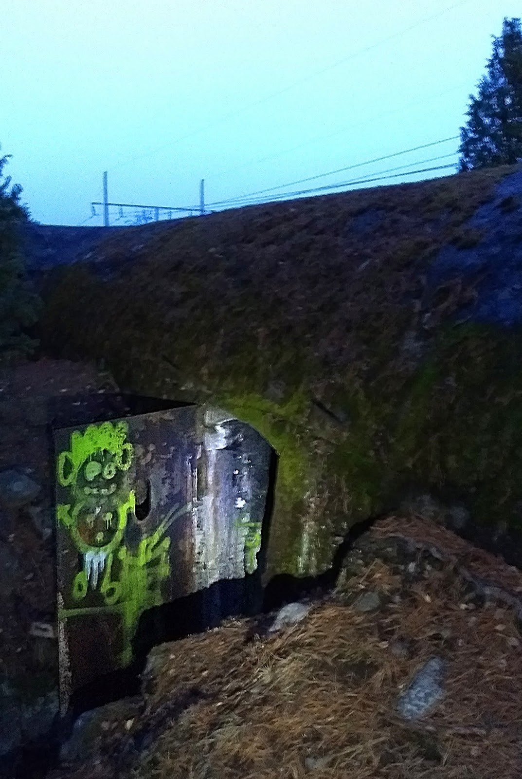
It is an interesting place, roughly 4m x 4m, and also about 4m high. There is a nice crack cave in front of the roof cave as well, and along the cliff line there were also a few other small roof caves, but perhaps too small to call real caves. But I didn't have time to look at them in detail on this trip.

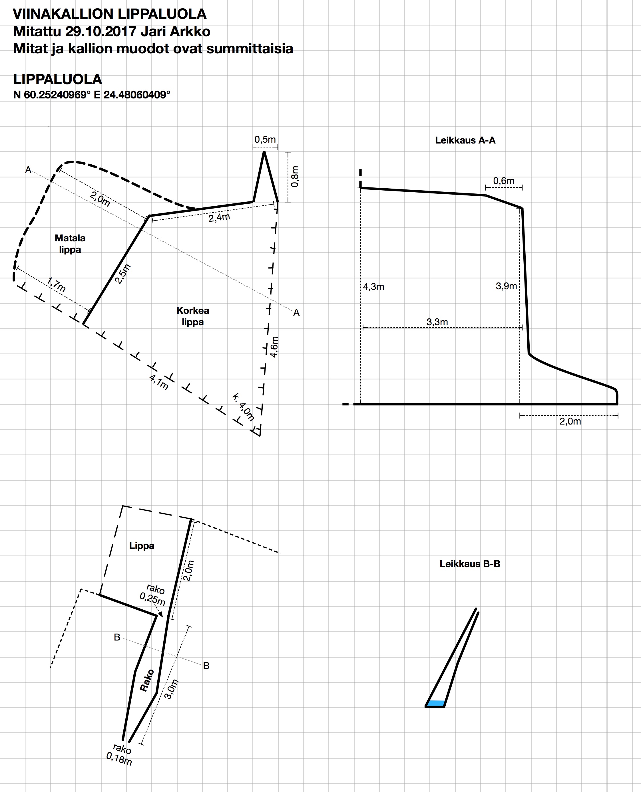
And now there's a map of this cave!


The high-res version of this map can be downloaded in JPG, PDF, or Apple Graphic formats. This is actually the last map of Kirkkonummi caves, except for three ones that are on military area, whose position is not known, or that have collapsed. And given Kirkkonummi's rocky countryside, there's likely also many unknown caves. But I have completed my mapping project of Kirkkonummi caves, for now, at least!

As I was returning back to the car in the Haapapuro/Kosko area, my headlamp was blazing at its boost setting. By the time I reach the car, a local man has noticed and has come up to investigate. He was wondering what the car parking at the intersection and the lights were about. I explained my cave mapping project, showed him pictures, showed the laser tools. It is important to keep the locals happy because hopefully others in the future will be able to drive and park and walk here as well. Most of the other small roads in the Veikkola area have been blocked off with locked gates. This man at least seems happy, had not known about the cave, and shared my hand at least fifteen times when I left :-)

The coordinates of the cave are N 60.25240969° E 24.48060409°.

More photos:


Crack cave:


Photos (c) 2017 by Jari Arkko. All rights reserved.

Saturday, October 28, 2017

Sonnimäki and Kalasberget Bunkers


Another weekend, another set of bunkers. Today me, Jarmo, and Velma went to explore further bunkers in the Sonnimäki and Kalasberget area. We found two interesting bunkers.

The bunker at Sonnimäki was a second one, we had looked at an almost intact one earlier. But today's bunker was blown up and filled with rocks. However, there seemed to be a small hole to squeeze in through, which we did. Turned out that you could still move around in the bunker, visit the other rooms and the main entrance tunnel, even if its end was filled.

This bunker felt like visiting a previously unseen cave; the entrance was tight and messy enough that we're not sure other people have been here since 1956. There were no signs or garbage inside.

The day's second bunker was in the Kalasberget hill nearby. We crossed the field and found first pile of dirt, reportedly covering one bunker that is no longer accessible. A bit further into the forest, just at the bottom of a cliff was a quite remarkable bunker. The gun and structures under it have been ripped out, but the round hole to the bunker underneath still remains, the straight down entrance hole with ladders remains, and the walk-in corridor entrance still remains (even if tight at the end). Interesting!

Based on Google Maps satellite pictures, we were hoping to find a third bunker nearby, as the pictures showed what looked like an open hole in the ground. Once we reached the place, however, we realised it was merely a tree that had fallen a long time ago, and left a hole in the ground. Oh well, it was a nice walk in the forest.

On the trip we also found a small roof cave next to the cliff at Kalasberget. Probably too small to properly classify as a cave (5 meters long and barely enough of a roof to stay out of rain).

We also visited a bunker that Jarmo and I had been to before, but Velma hadn't. We confirmed the length of the long stalactite as being roughly 25 cm. And Jarmo took some more of his great pictures.

Coordinates for the Sonnimäki bunker are N 60.16220321° E 24.48039296°. The Kalasberget bunker is at N 60.16033893° E 24.46882004°. And the previously visited Sonnimäki bunker was at N 60.16092596° E 24.47613065°. As usual, we're searching bunkers based on the Lynx map, augmented by the Google Maps pictures and other additional documents referred to above.

Sonnimäki bunker:


Kalasberget bunker:


New pictures from the earlier Sonnimäki bunker:


Photos (c) 2017 by Jari Arkko and Jarmo Ruuth. All rights reserved.